
Creating Walkable Communities
Active travel – be that walking, cycling or scooting – carries many well known benefits. It’s typically cheaper than alternative modes of travel, it’s good for our health, less harmful to the environment and eases congestion on our roads.
Despite these obvious benefits, many barriers remain which prevent increases in the uptake of active forms of travel.
One way to encourage active travel is to promote the development of more ‘walkable communities’ – designing places which encourage and support people to be active, by making walking, cycling and other forms of active travel easier and more enjoyable. This should include;
Consideration of Travel Distances
Neighbourhoods should be planned to maximise walkability, with residents and workers able to easily and conveniently move between key facilities and services – such as shops, schools, workplaces, parks, playgrounds and open spaces etc. – using active travel methods.

Appropriate co-location of such amenities should be considered, reducing the reliance of private vehicles to move between multiple facilities and services spread throughout a place.
Co-location may cut across a broad range of features – as has been promoted in Melbourne through the ‘Features of a 20-minute neighbourhood’.
Source: Department of Environment, Land, Water and Planning, Victoria State Government

Commitments could be made to set a requirement for residents to be able to access identified key places and services within a defined active travel time (as is the case with various initiatives and principles such as 15-minute cities, 20-minute neighbourhoods etc.).
“Timer at 0” by numb3r is licensed under CC BY-SA 2.0
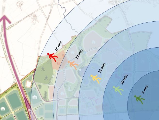
The design of places could include identification of such travel times across a development, showing estimated duration/distances and the specific anticipated routes showing desire lines and considering the ‘user journey’ in using such routes.
The Nature and Quality of Routes
Distance and development density is not the only key factor in the creation of walkable communities. Design should also take into account the experience of those engaging in active travel.

Routes should be direct and easily legible – active travel should not require a detour away from a direct route versus the private vehicle, and routes should not be tucked away out of sight at the edge of development or hidden amongst other infrastructure. To maximise walkability such infrastructure should be prominent and direct.
“Rush Hour on the Dunsmuir Separated Bike Lane” by Paul Krueger is licensed under CC BY 2.0

Design quality and appropriate management of a place should ensure that routes are well maintained and enjoyable to navigate.
“Walk” by Asela is licensed under CC BY 2.0
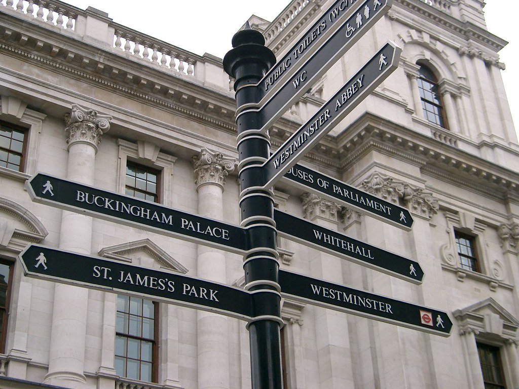
Measure could be considered to promote active travel routes – through appropriate, high-quality signposting to provide a visible ‘nudge’ to encourage use.
“Signpost Near Buckingham Palace” by edwin.11 is licensed under CC BY 2.0
Safety and Security
Design which fails to provide a sense of safety is likely to fail in maximising active travel outcomes. Perceptions of safety pose a significant barrier to engaging more people across communities in cycling and walking.

The places where people are active should have good natural surveillance to reduce risk of crime, anti-social behaviour etc. which could detract from positive use of such infrastructure for the purpose of travel.
“Couples in Paris park” by zoetnet is licensed under CC BY 2.0

Routes should be well-lit to provide an increased sense of safety and security.
“Night walk” by ricardogz10 is licensed under CC BY 2.0

Standard in design and build should consider how to maximise uptake – such as through protection from traffic, and safe crossing points which reduce delays/obstructions along a journey.
“Two Way Cycle Lane Across Light Controlled Junction” by samsaundersbristol is licensed under CC BY-SA 2.0

Appropriate supporting infrastructure should be provided to encourage uptake – such as cycle storage facilities at carefully identified key destinations which is of a high quality and positioned in a safe, prominent position, as well as storage space within homes to make ownership of a bicycle more feasible.
“New Bike Rack in Worthington, Ohio” by dok1 is licensed under CC BY 2.0
Further content is available throughout Healthy Place Making to support the design and development of walkable communities, in addition to a range of further reading selected below.
Make the most of the Healthy Place Making platform
As well as ensuring you are always in the know about future changes and updates to Healthy Place Making, registering with us will enable to you to curate your own project boards that you can share with others – helping you to embrace the Healthy Place Making approach to find, curate and collaborate on making healthier places for all of our residents.